No. 006December 1, 2025 · 7 min read
An Atlas of the Lakes Region
Two old maps, four town panoramas, and what they tell a turner about the wood that came after.
An old map of a place where you live is a kind of mirror that does not quite line up. The shape is mostly right. The names mostly are. The land between the names is what the cartographer guessed at, or left blank, or filled in from a story he had been told twice.
The shop in Sanbornton sits in the middle of one of those once-blank stretches. Two state maps hang above the bench, and a small stack of bird's-eye lithographs lives on a shelf nearby. They are not pretty things. They are working documents, the way a topographic survey is a working document, or the inventory of a wood rack. They tell the workshop, a little less every year, what the country was when the trees that come through here were not yet trees.
I. The country before, 1796
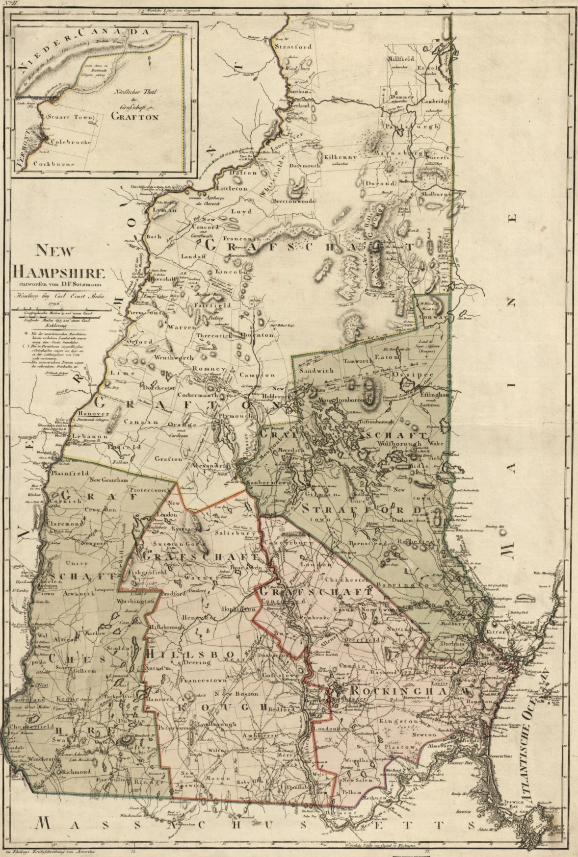
The first detailed map of New Hampshire published in Europe was the work of Daniel Friedrich Sotzmann, a Prussian cartographer working for the geographer Christoph Ebeling in Hamburg. It came out in 1796, twenty years after independence. New Hampshire was a thin sliver of a state, sixteen years old as a member of the Union, with a coast about thirteen miles long and a back country that nobody in Hamburg had ever walked. Sotzmann had to compile it from manuscripts, captains' charts, and the testimony of a few colonial surveyors.
What he produced is gorgeous and slightly wrong. The Connecticut River runs in roughly the right place. The White Mountains are sketched in. The Lakes Region appears as a knot of waterways with most of the lakes that exist now and a few that do not. The county names are in German: Grafschaft Coos, Grafschaft Strafford, Grafschaft Hillsboro. A small inset shows Lower Canada and the Grafton hills, the country Sotzmann's audience would have wanted oriented to.
What the map cannot show is the forest, because almost the entire state is the forest. The settlements are dots. The roads are thin lines pulled between them. The land between the lines is empty in the way an early map is empty. Not because nothing is there, but because the cartographer's information ran out.
II. The country drawn, 1827
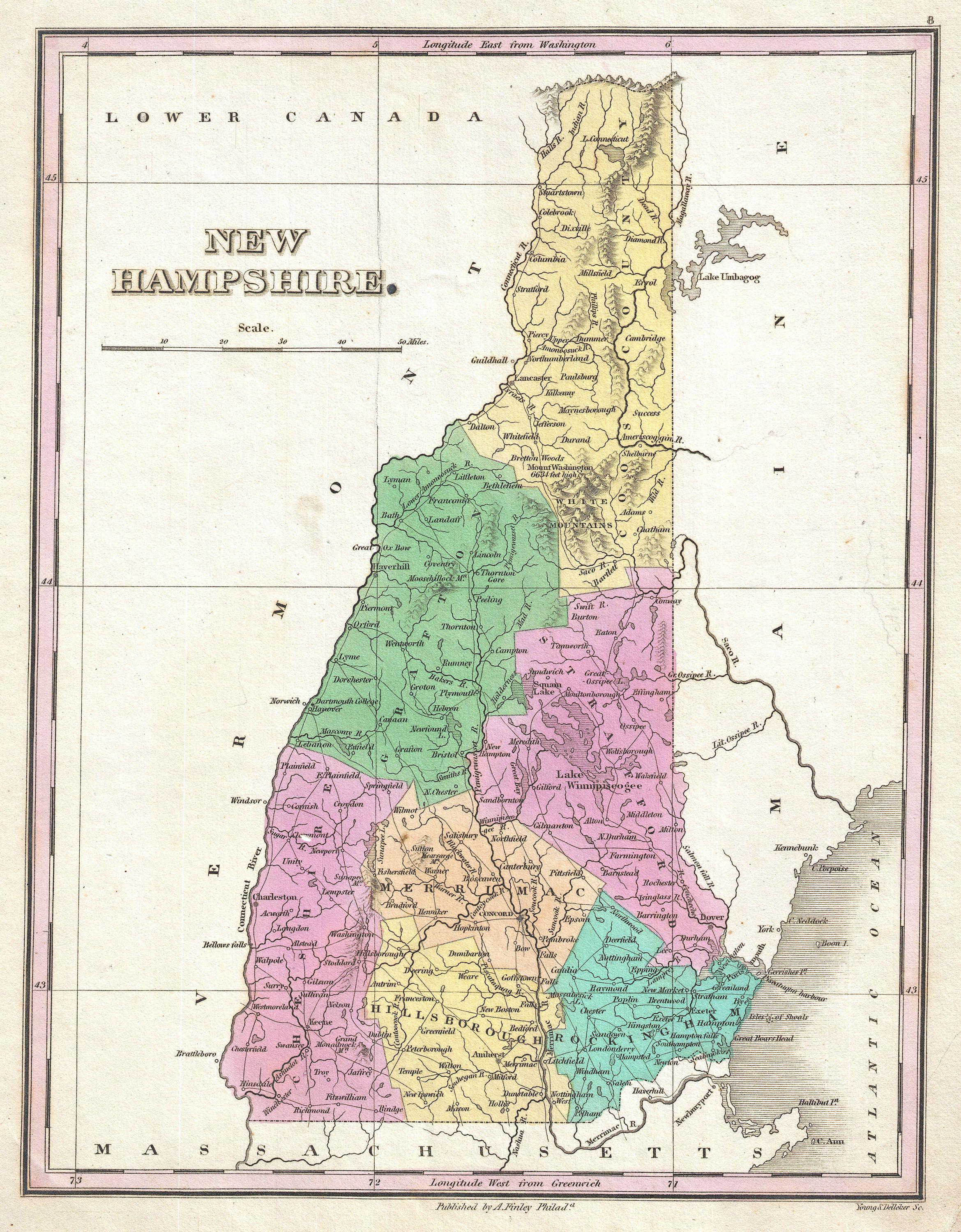
Anthony Finley's atlas of 1827 shows the same state thirty years later, and what has happened to it in those thirty years is visible at a glance. The counties are colored. Roads thread through every settlement. The river systems are charted properly. Lake Winnipesaukee, which Sotzmann labeled mostly by guess, has its real shape and its real fingers. Towns that did not exist in 1796 are on the page. The state has been measured.
The thing the map is also recording, without saying so, is the start of the sheep boom. By 1827, farmers across southern New Hampshire were clearing pastures for merino sheep, and the lower elevations of the state were beginning to look like the cleared, pieced country an English shepherd would have recognized. The forest the second forest would later grow back into is the forest being taken down on Finley's map. He did not draw a single tree.
Most of the Lakes Region names on Finley's plate are the ones a person who lives here today still says: Plymouth, Holderness, Center Harbor, Wolfeboro, Salisbury. A few have moved on. The town the map labels New Salem is now Meredith. The river the map labels Salem is now Salmon Brook. The shop sits a few miles south of either one, in the town the map calls Sanbornton and the map is right.
“A map records the field. A bird's-eye records the town. The forest is between them, and the forest is what becomes the wood.”
III. The towns at the bend
By the 1880s the Lakes Region had become a string of mill towns along the bend in the Pemigewasset and Winnipesaukee rivers, and the bird's-eye lithograph was the way a town like that wanted to see itself. An artist would arrive, walk the streets for several weeks sketching individual buildings, consult the town's land records, and assemble a panorama from a viewpoint above the village that did not actually exist. The drawing would hang in the window of the bookstore or the newspaper office for residents to inspect and correct. An agent then went door to door selling subscriptions to the finished print. Five thousand of these views were published in North America in the nineteenth century. Every small town wanted one.
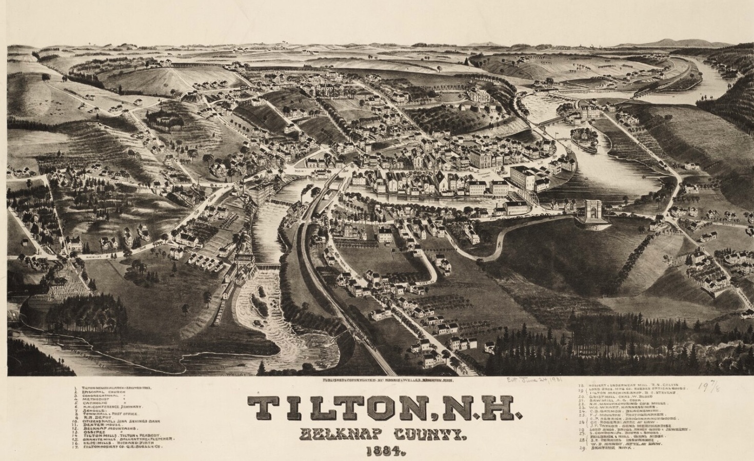
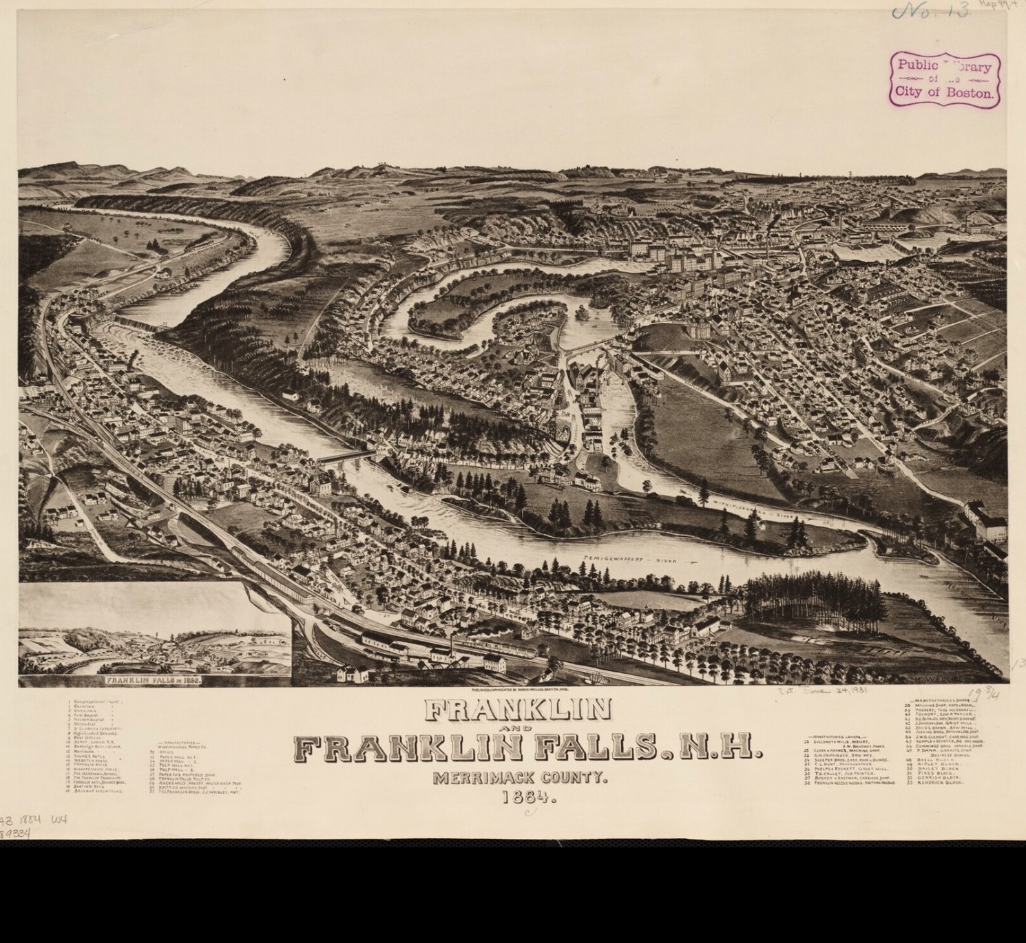
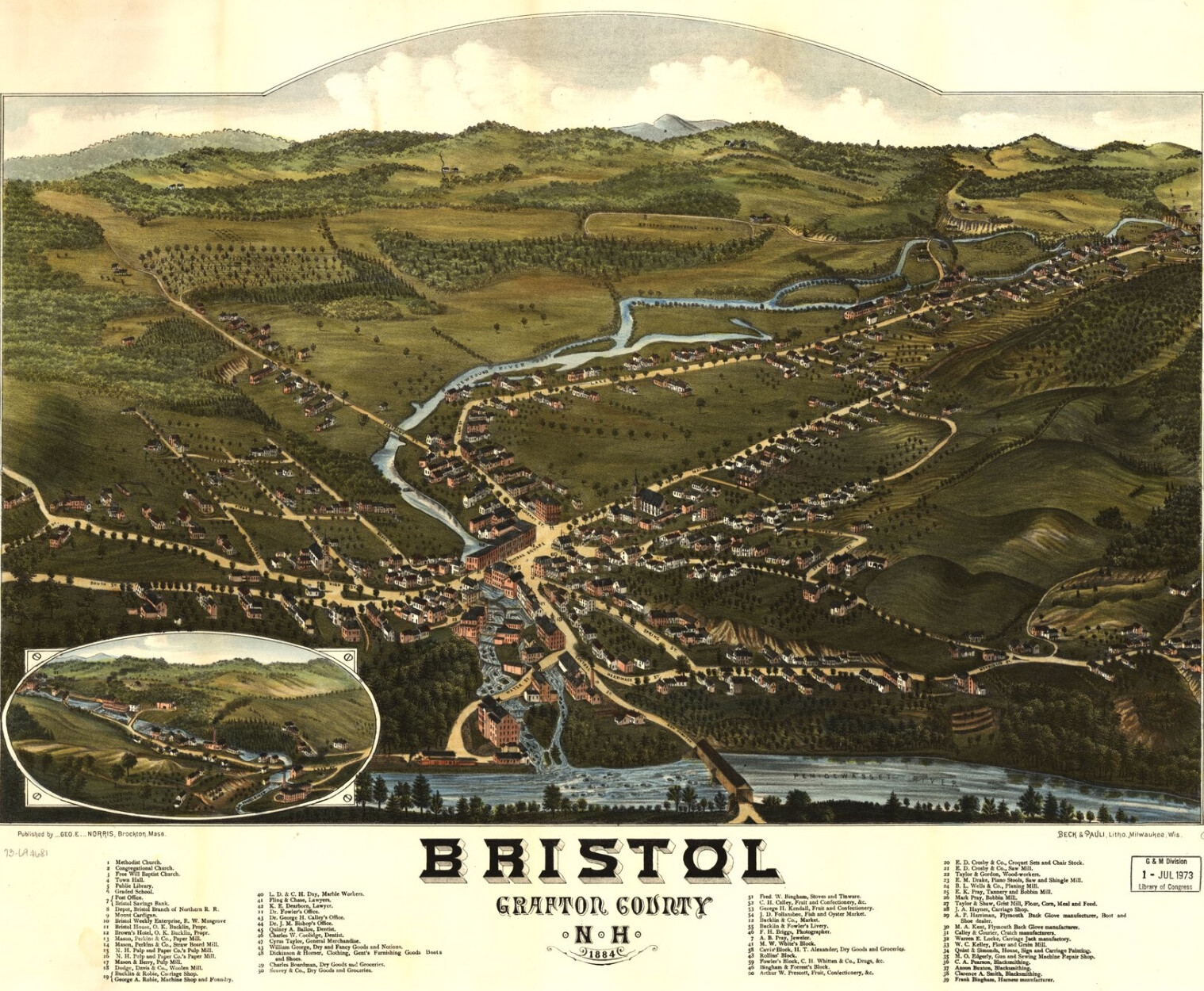
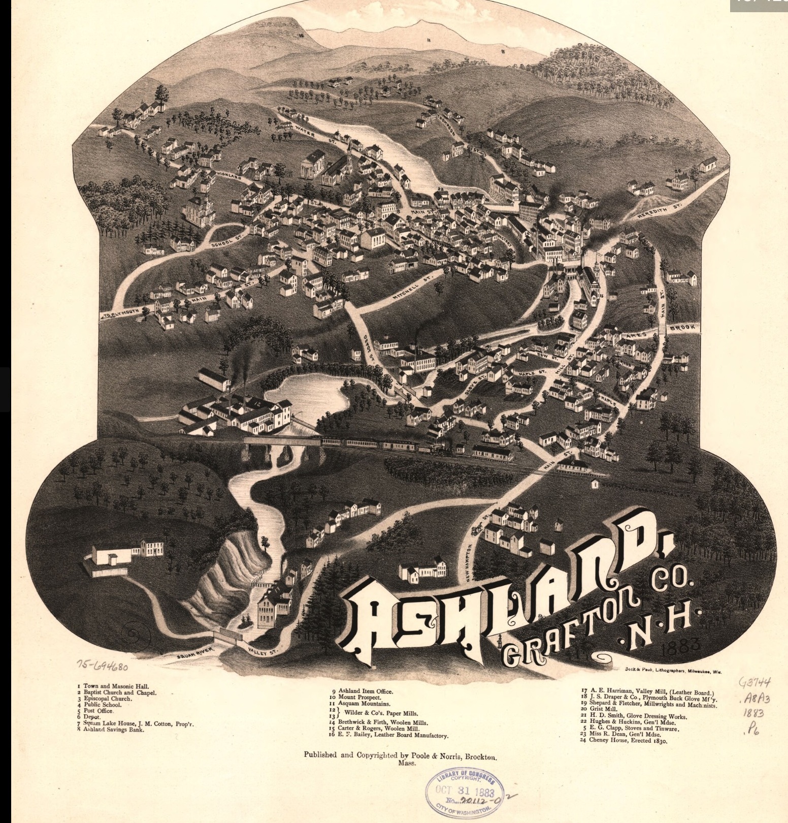
Tilton, Franklin Falls, Bristol, Ashland. Four towns within fifteen miles of each other. All four built on the same drainage. All four drawn the same way, by the same kind of itinerant artist, in the same decade. What the four panoramas show together is a pattern. A river at the center. A mill or two on its banks. A church spire. A grid of houses laid into the cleared fields. A rail line just laid, running out of the picture toward the next town. The forest, in every one of them, has been pushed back to the ridgelines.
IV. The lake as a highway
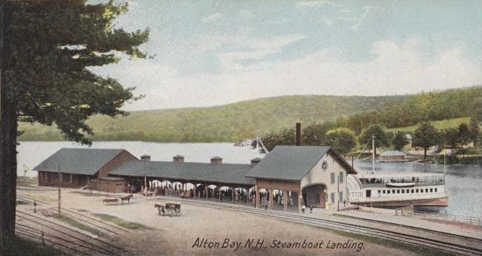
Before the roads were paved, the lake itself was the road. Steamboats ran from Alton Bay across Winnipesaukee to Wolfeboro, Center Harbor, and Long Island, with the original Mount Washington running the route from her launch in 1872 until a fire took her in 1939. The landing at Alton Bay was where the boat met the train, the southern end of the lake's transit network. A bowl turned in the workshop today might have begun as a tree on a parcel that, in 1900, would have been reached by a steamer.
V. What is still here
The wood that comes through this shop is the wood of the second forest, the one that came back after the bird's-eye views were drawn. A maple turned green this morning might have started as a seedling at the edge of one of the cleared fields visible in those panoramas. A cherry burl might come from a tree that took root after the sheep were sold off, after the mill town reached its largest, after the photographers and lithographers had moved on to the next valley.
The maps are not nostalgia. They are a record of what the second forest was given to grow back into. To turn a bowl from this wood is, in some small way, to handle the answer the forest gave.
From this writingThe bench
See the pieces it
points to.
Every wood in this post is on the bench right now. Birch, maple, cherry burl, walnut, beech, and white pine.
Browse the bench